

cross-posted from: https://piefed.world/c/onion/p/1298227/the-us-government-presented-a-sloppy-ai-generated-map-of-africa-at-the-global-aids-confe
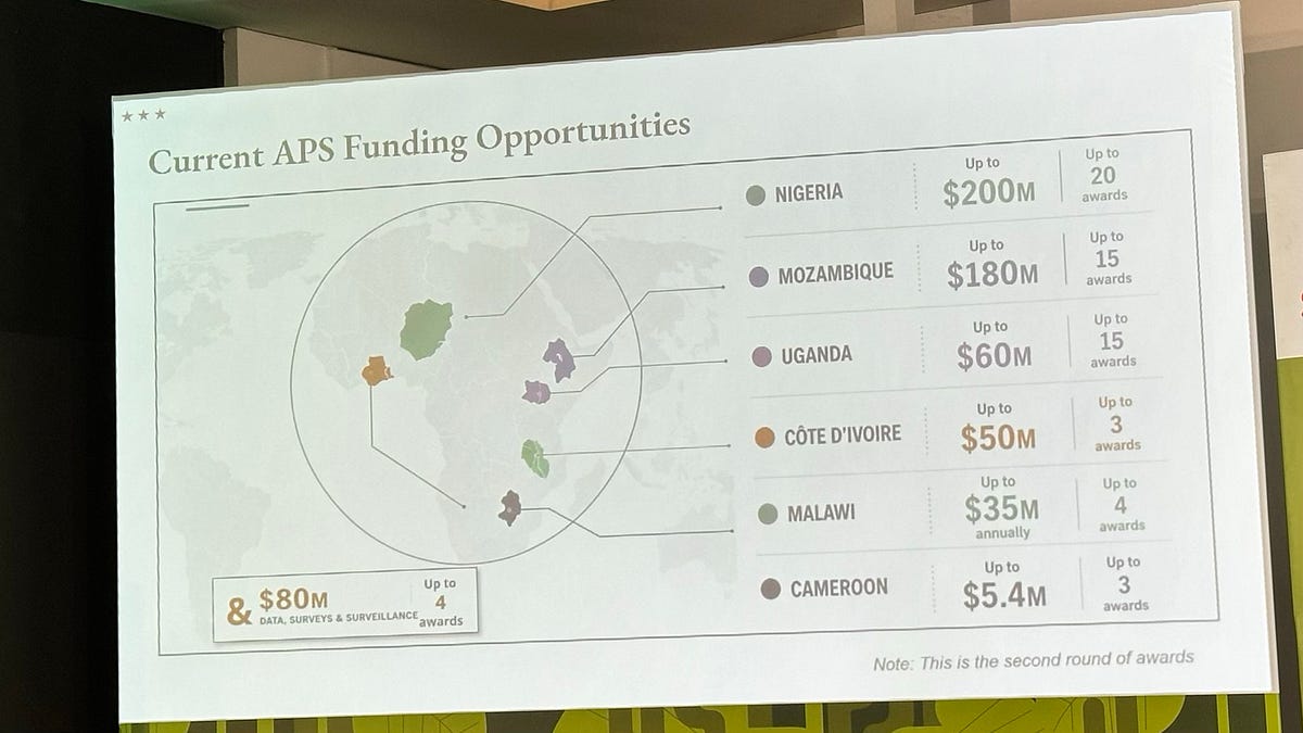
A senior US State Department official displayed a map of Africa that was completely wrong before high-level officials from African nations, including some whose countries had been mislabelled. The map mishap occurred during a presentation at “Transforming health assistance: Implementing U.S. government MOUs for sustainable HIV programs,” a pre-conference event at the largest AIDS conference in the world, held this year in Rio de Janeiro.

The map mis-identified the locations of Cote d’Ivoire, Mozambique, Nigeria by enormous margins—making Nigeria landlocked, Mozambique an east African nation and Cote d’Ivoire a southern African state. The map put Uganda and Malawi in the right vicinity, but with the wrong borders. And it nope’d out altogether for Cameroon, which doesn’t have a line connecting the name to a country at all. (There is also a country without a name Alas, they are not a match.)
Reuters found that the image of the map included in the presentation contained an artificial intelligence watermark that signals it was made with OpenAI tools.